3D pointcloud moonpool

3d solutions

Westcon Yards
Services
3D Solutions

In its area, Westcon 3D is one of the central players in the oil and gas sector, as well as the rest of the maritime field.

Westcon 3D – Precision You Can See

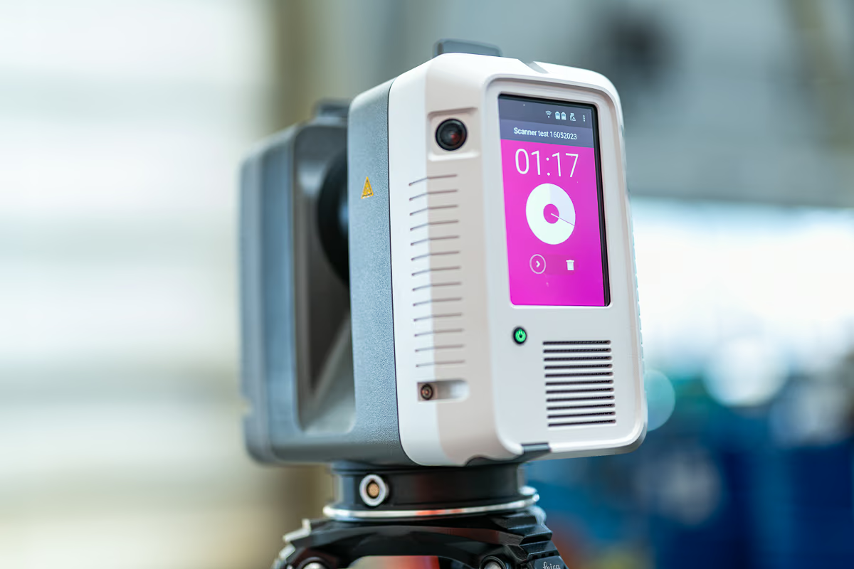
Westcon 3D transforms industrial surveying with cutting-edge 3D laser scanning and proprietary software, delivering unmatched accuracy and flexibility across the oil & gas and maritime sectors.

What We Offer:

  • High-precision surveys using 3D laser scanners and total stations (TSTs) – accurate to 1–2 mm
  • Global reach – surveys for offshore and onshore installations worldwide
  • WLP (Westcon Laser Portal) – our own software that visualizes and combines measurement data in a user-friendly format
  • Digital environments – enabling re-measurement at any time and supporting dimensional control for accurate prefabrication
  • Fast recreation of GI drawings with millimeter precision
  • Reduced errors and time – laser scanning replaces manual measuring for faster, more reliable results

Our Expertise:

Our team of specialists in Trondheim, Haugesund, and Stavanger brings years of experience and innovation to every project.

Kollasj av bilder som viser teknologibruk i offshore, maritim og byggesektorer, inkludert 3D-skanning, ingeniører i arbeid og industrielle installasjoner.
Download our brochure

Surveying Services – Precision Data for Smarter Decisions

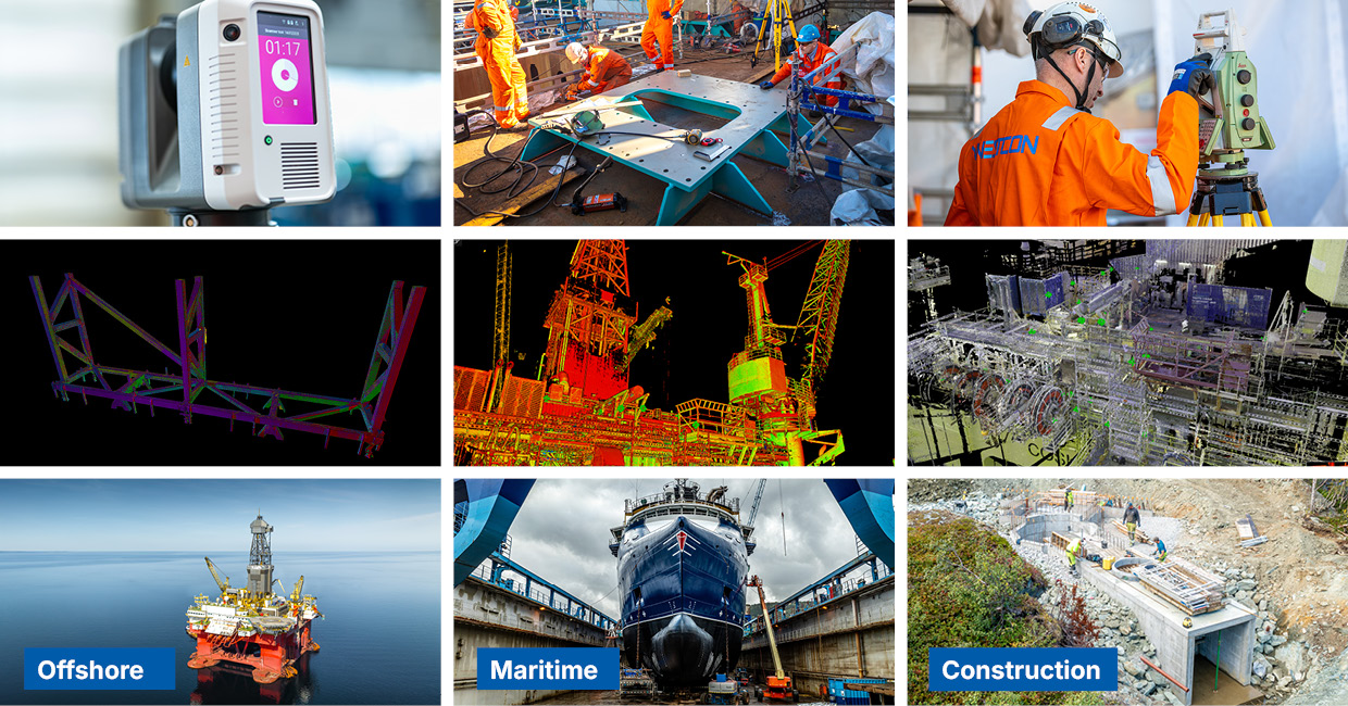
Westcon 3D delivers high-accuracy surveying solutions for offshore, maritime, and land-based projects worldwide. Our advanced tools and experienced teams ensure reliable data collection and visualization.

Our Capabilities:

  • 3D Laser Scanning – Accurate to 1–2 mm for industrial-grade precision
  • Dimensional Control – Ensures correct fit and alignment for prefabrication
  • Volume Calculations – For material planning and structural analysis
  • Grid Establishment – On offshore installations, vessels, and land-based constructions
  • Tag Creation and Processing – For efficient data tracking and documentation
  • Photo & Video Documentation – Visual records for reporting and analysis
  • Aerial Surveying & Photogrammetry – Drone-based data capture for large-scale environments

Programming data processing and visualisation

  • 3D Modeling – High-quality digital models for design, visualization, and production.
  • Visualization & Animation – Realistic renderings and animations to bring concepts to life.
  • 3D Printing – Rapid prototyping and production using advanced additive manufacturing.
  • Simulation – Performance testing and analysis through virtual simulations.
  • CAD Design – Precise and efficient design using industry-standard CAD tools.
  • Clash Detection & Resolution – Identifying and resolving design conflicts before construction.
  • Reverse Engineering – Reconstructing digital models from physical objects.
  • As-Built Documentation – Accurate documentation of completed projects for reference and compliance.
Leica RTC 360 laser scanner

Administration, Programming and Development

  • Coupling Between WLP and External Systems – Seamless integration with key platforms to ensure data consistency and operational efficiency, including:
  • Maintenance Databases – Synchronization of asset data, service records, and maintenance schedules.
  • Project Planning Tools – Linking timelines, resources, and milestones for better coordination.
  • Installation Studies – Integration of design and planning data to support accurate installation analysis.
  • Software Development – Custom interfaces and APIs to extend functionality and enable automation.
  • Software Maintenance – Continuous updates and support to ensure system reliability and performance.
  • CAD System Management – Centralized control and interoperability between design environments and project databases.

E-Learning

We develop realistic and efficient e-learning experiences through internet-based training (e-courses).

By utilizing advanced scanning and photography of training objects and their surroundings, we create highly accurate virtual environments. These environments are often so detailed and immersive that they can effectively replace traditional classroom-based courses.

From these digital environments, we build interactive training mo

Westcon Laser Portal - WLP

A Powerful Tool for Visualizing 3D Laser Scan Data

Westcon Laser Portal (WLP) is a proprietary web-based platform designed to visualize data captured by 3D laser scanners.

Using photorealistic panoramic images, WLP allows users to explore scanned environments directly in a standard web browser or on mobile devices such as iPhones and iPads.

With intuitive tools, users can:

  • Zoom, pan, and navigate the scanned environment
  • Mark and comment on specific areas or objects
  • Measure distances and coordinates with an accuracy of 2-3 mm
  • Export measurements and share them online
  • Break down measurements into X, Y, and Z coordinates

Key Features and Possibilities:

  • View 3D laser scans directly in a browser or on mobile devices
  • Access accurate 3D as-built models
  • Explore full-color photorealistic images
  • Mark and annotate areas and objects
  • Measure distances and coordinates with millimeter precision
  • Easily share information with colleagues and stakeholders
  • Import CAD models for comparison and integration
  • Verify design changes and ensure quality
  • Detect and prevent clashes (clash control)
  • Save time and reduce costs
  • All within a user-friendly, self-explanatory interface

Cultural heritage

Cultural Heritage Documentation & Visualization

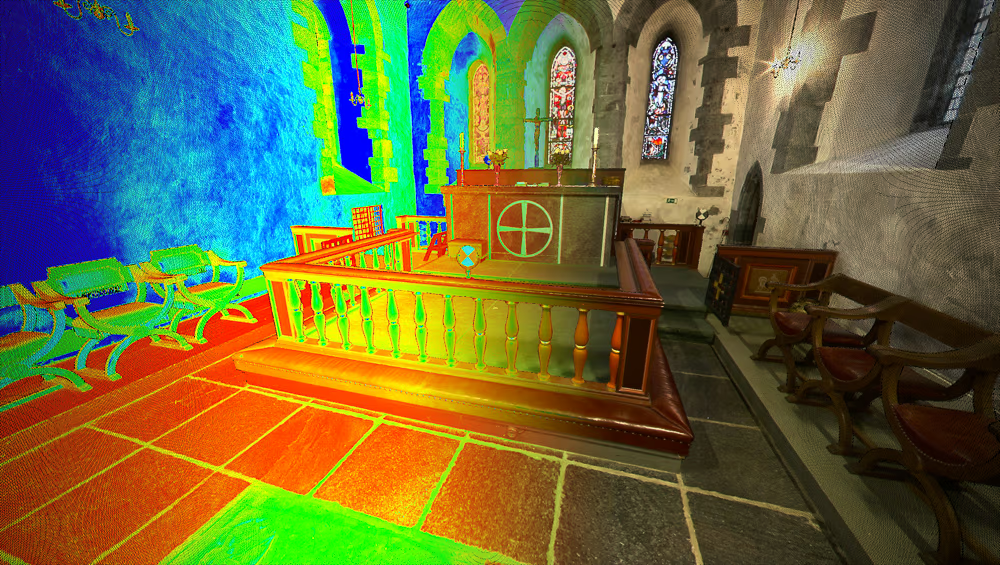
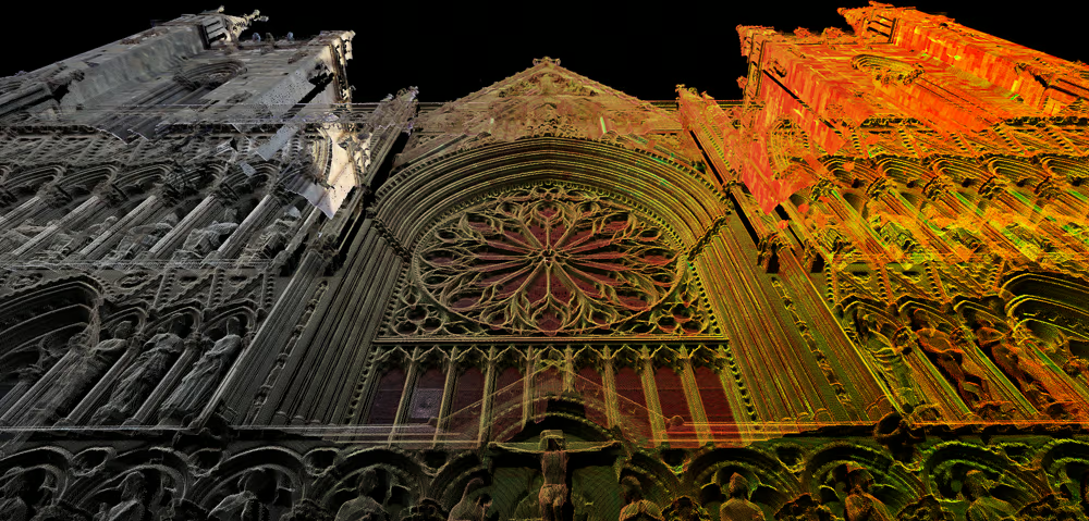
We offer advanced solutions for documenting and visualizing cultural heritage sites, archaeological environments, and historical architecture.

Our technology enables the creation of highly accurate digital representations of historical buildings and environments. A prime example is www.olavskirken.no, where we collaborated with a multidisciplinary team including theologians, church administrators, cultural and historical mediators, archaeologists, tourism developers, and designers. The result is a rich, interactive experience that showcases the potential of digital heritage preservation.

Key Benefits:

  • Photorealistic Visualization – Using laser scanning and HDR photography, we recreate environments with stunning detail.
  • Point Cloud Animation – For Avaldsnes Church(Olavskirken), we produced a unique animation using only point cloud data—no video cameras involved. The animation lets you “fly” through approximately 3 billion laser points captured from over 70 positions inside and outside the church.
  • Colorized Laser Data – HDR still photography is used tocolorize the point cloud, enhancing realism and spatial understanding.
  • Multidisciplinary Collaboration – Our projects bring together experts from various fields to ensure historical accuracy, cultural sensitivity, and engaging presentation.
  • Accessible Online Platforms – The final visualizations are made available through user-friendly web portals, accessible on desktop and mobile devices.

Contact

Pawel Tondel
Pawel Tondel
Senior Survey Engineer • 3D Solutions
No widows